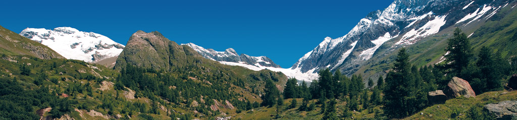
Carte pédestre / Wanderkarte / Carta escursionistica / Hiking Map / + GPS-compatible + Édition 2014 / Ausgabe 2014 / Edition 2014
SuisseMobile > La Suisse à pied - La Suisse à VTT - La Suisse à vélo SchweizMobil > Wanderland Schweiz - Mountainbikeland Schweiz - Veloland Schweiz SvizzeraMobile > La Svizzera a piedi - La Svizzera in mountain bike - La Svizzera in bici SwitzerlandMobility > Hiking in Switzerland - Mountainbiking in Switzerland - Cycling in Switzerland Composition de cartes dans l'échelle 1:25'000. Tous les chemins de randonnée pédestre. Informations utiles pour les amateurs de plein air. / Kartenzusammensetzung im Massstab 1:25'000. Alle signalisierten Wanderwege. Nützliche Informationen für Outdoor-Geniesser. / Map composition at scale 1:25'000. All signalized hiking trails. Providing useful information for outdoor lovers
Amriswil - St. Gallen - Appenzell Carte pédestre / Wanderkarte / Carta escursionistica / Hiking Map / + GPS-compatible + Édition 2018 / Ausgabe 2018 / Edition 2018
Maloja, Vicosoprano, Stampa, Bondo, Soglio, Castasegna, Chiavenna Carte pédestre / Wanderkarte / Carta escursionistica / Hiking Map / + GPS-compatible + Édition 2014 / Ausgabe 2014 / Edizione 2014
Sierre, Vercorin Carte pédestre / Wanderkarte / Carta escursionistica / Hiking Map / + GPS-compatible + Nouvelle édition 2020 / Neuausgabe 2020 / New Edition 2020
Carte pédestre / Wanderkarte / Carta escursionistica / Hiking Map / + GPS-compatible + Édition 2019 / Ausgabe 2019 / Edition 2019
Pays de Neuchâtel Carte pédestre / Wanderkarte / Carta escursionistica / Hiking Map Édition 2009 / Ausgabe 2009 / Edition 2009
Carte pédestre / Wanderkarte / Carta escursionistica / Hiking Map Nouvelle Édition 2021 / Neue Ausgabe 2021 / New Edition 2021
SuisseMobile > La Suisse à pied - La Suisse à VTT - La Suisse à vélo SchweizMobil > Wanderland Schweiz - Mountainbikeland Schweiz - Veloland Schweiz SvizzeraMobile > La Svizzera a piedi - La Svizzera in mountain bike - La Svizzera in bici SwitzerlandMobility > Hiking in Switzerland - Mountainbiking in Switzerland - Cycling in Switzerland Tous les chemins de randonnée pédestre avec temps de marche. Informations utiles pour les amateurs de plein air. / Alle signalisierten Wanderwege mit Marschzeiten. Nützliche Informationen für Outdoor-Geniesser. / All signalized hiking trails with walking times. Providing useful information for outdoor lovers
Espace Mont-Blanc Carte pédestre / Wanderkarte / Carta escursionistica / Hiking Map / + GPS-compatible + Édition 2015 / Ausgabe 2015 / Edition 2015
SuisseMobile > La Suisse à pied - La Suisse à VTT - La Suisse à vélo SchweizMobil > Wanderland Schweiz - Mountainbikeland Schweiz - Veloland Schweiz SvizzeraMobile > La Svizzera a piedi - La Svizzera in mountain bike - La Svizzera in bici SwitzerlandMobility > Hiking in Switzerland - Mountainbiking in Switzerland - Cycling in Switzerland Composition de cartes dans l'échelle 1:25'000. Tous les chemins de randonnée pédestre. Informations utiles pour les amateurs de plein air. / Kartenzusammensetzung im Massstab 1:25'000. Alle signalisierten Wanderwege. Nützliche Informationen für Outdoor-Geniesser. / Map composition at scale 1:25'000. All signalized hiking trails. Providing useful information for outdoor lovers.
Carte pédestre / Wanderkarte / Carta escursionistica / Hiking Map Édition 2011 / Ausgabe 2011 / Edition 2011
Grandson, Orbe, Romainmôtier, Sainte-Croix/Les Rasses, Vallorbe, Yvonand, Yverdon Carte pédestre / Wanderkarte / Carta escursionistica / Hiking Map / + GPS-compatible + Édition 2016 / Ausgabe 2016 / Edition 2016