HOMM interactive - Agentur für für Webdesign und Corporate Design in Luzern
Online Shop

Online Shop

4 Vallées

Thyon - Les Collons - Veysonnaz - Nendaz - La Tzoumaz - Isérables - Verbier  > Édition 2010 
Carte panoramique avec itinéraires pédestres / Panoramakarte mit Wanderwegen / 
Carta panoramica con sentieri turistici / Panoramic map with hiking tracks

Mehr Informationen
CHF 12.80

Le paysage pictural un coup d'œil. Des sentiers de randonnée avec les temps de marche dans les deux sens. Informations touristiques.
Die bildhafte Landschaft auf einen Blick. Wanderwege mit Marschzeiten und Richtungsangaben. Touristische Informationen.
Il paesaggio pittoresco a colpo d'occhio. Sentieri escursionistici con tempi di marcia e direzione. Informazioni turistiche.
The pictorial landscape at a glance. Hiking trails with walking time for both direction. Tourist information.

Alpes Vaudoises

Waadtländer Alpen - Saanenland / Alpi Vodesi / Vaud Alps  > Édition 2016 
Carte panoramique avec itinéraires pédestres / Panoramakarte mit Wanderwegen / 
Carta panoramica con sentieri turistici / Panoramic map with hiking tracks

Mehr Informationen
CHF 12.80

Carte panomarique avec itinéraires pédestres et cyclotourisme. Parcours VTT.
Panoramakarte mit Wanderwegen und Velotouren. Mountain Bike Routen.
Carta panoramica con i sentieri per escursioni e gite in bicicletta. Mountain Bike Route.
Panoramic map with hiking trails and bicycle tours. Mountain Bike Tours.

Fribourg

Canton de Fribourg / Kanton Freiburg / Cantone di Friburgo / Canton Fribourg > Édition 2006 
Carte panoramique / Panoramakarte / Carta panoramica / Panoramic map

Mehr Informationen
CHF 12.80

Carte panomarique avec itinéraires pédestres et cyclotourisme
Panoramakarte mit Wanderwegen und Velotouren
Carta panoramica con i sentieri per escursioni e gite in bicicletta
Panoramic map with hiking trails and bicycle tours

Mont Blanc

Tour du Mont Blanc > Édition 2017 
Carte panoramique avec itinéraires pédestres / Panoramakarte mit Wanderwegen / 
Carta panoramica con sentieri turistici / Panoramic map with hiking tracks

Mehr Informationen
CHF 12.80

Le paysage pictural un coup d'œil. Des sentiers de randonnée avec les temps de marche dans les deux sens. Die bildhafte Landschaft auf einen Blick. Wanderwege mit Marschzeiten und Richtungsangaben. Il paesaggio pittoresco a colpo d'occhio. Sentieri escursionistici con tempi di marcia e direzione. The pictorial landscape at a glance. Hiking trails with walking time for both direction.

Suisse Romande

Suisse Romande - Franche-Comté - Jura > Édition 2007 
Carte panoramique / Panoramakarte / Carta panoramica / Panoramic map

Mehr Informationen
CHF 12.80

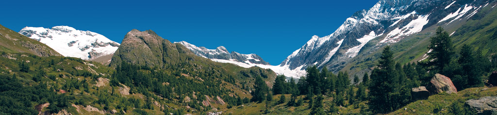
Le paysage pictural un coup d'œil. Des sentiers de randonnée, pistes cyclables et des informations touristiques.
Die bildhafte Landschaft auf einen Blick. Wanderwege, Radwanderwege und touristische Informationen.
Il paesaggio pittoresco a colpo d'occhio. Sentieri escursionistici, piste ciclabili e informazioni turistiche.
The pictorial landscape at a glance. Hiking trails, bicycle trails and tourist information.

Val d'Anniviers

Val de Zinal  -  Val de Moiry > Édition 2012 
Carte panoramique avec itinéraires pédestres / Panoramakarte mit Wanderwegen / 
Carta panoramica con sentieri turistici / Panoramic map with hiking tracks

Mehr Informationen
CHF 12.80

Le paysage pictural un coup d'œil. Des sentiers de randonnée avec les temps de marche dans les deux sens. Informations touristiques.
Die bildhafte Landschaft auf einen Blick. Wanderwege mit Marschzeiten und Richtungsangaben. Touristische Informationen.
Il paesaggio pittoresco a colpo d'occhio. Sentieri escursionistici con tempi di marcia e direzione. Informazioni turistiche.
The pictorial landscape at a glance. Hiking trails with walking time for both direction. Tourist information.

Val d'Hérens

Val d'Hérens - Val d'Arolla - Val d'Hérémence > Édition 2021 
Carte panoramique avec itinéraires pédestres / Panoramakarte mit Wanderwegen / 
Carta panoramica con sentieri turistici / Panoramic map with hiking tracks

Mehr Informationen
CHF 12.80

Le paysage pictural un coup d'œil. Des sentiers de randonnée avec les temps de marche dans les deux sens.
Die bildhafte Landschaft auf einen Blick. Wanderwege mit Marschzeiten und Richtungsangaben.
Il paesaggio pittoresco a colpo d'occhio. Sentieri escursionistici con tempi di marcia e direzione.
The pictorial landscape at a glance. Hiking trails with walking time for both direction.

Valais / Wallis

Valais / Wallis / Vallese > Édition 2012 
Carte panoramique / Panoramakarte / Carta panoramica / Panoramic map

Mehr Informationen
CHF 9.80

Le paysage pictural un coup d'œil toutes les informations touristiques.
Die bildhafte Landschaft auf einen Blick mit touristischen Informationen.
Il paesaggio pittoresco a colpo d'occhio tutte le informazioni turistiche.
The pictorial landscape at a glance with tourist information.

Vallée du Trient

Vallée du Trient - Dents du Midi - Clacier du Trient  > Édition 2016 
Carte panoramique avec itinéraires pédestres / Panoramakarte mit Wanderwegen / 
Carta panoramica con sentieri turistici / Panoramic map with hiking tracks

Mehr Informationen
CHF 12.80

Le paysage pictural un coup d'œil. Des sentiers de randonnée avec les temps de marche dans les deux sens.
Die bildhafte Landschaft auf einen Blick. Wanderwege mit Marschzeiten und Richtungsangaben.
Il paesaggio pittoresco a colpo d'occhio. Sentieri escursionistici con tempi di marcia e direzione.
The pictorial landscape at a glance. Hiking trails with walking time for both direction.

1 bis 9 von 9  [ <<  1  >> ]
Online Shop | edition mpa  |  Orell Füssli Kartographie AG